New 600-mile lost Sierra trail to 15 forgotten small towns

Nearly two years of living amid a global pandemic has taught people the value of being able to escape sedentary lockdown living and go explore the great outdoors. And, if you’re looking for a place to go, California is always a pretty attractive option, with relatively mild temperatures year-round and a wide selection of different terrain types.
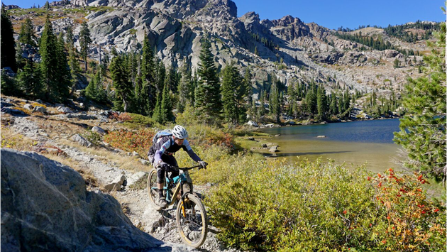
The Connected Communities Project aims to soon offer outdoor enthusiasts a new 600-mile network of multi-use trails running through the alpine forests of northeastern California and northwestern Nevada, in a region where the magnificent Sierra Nevada Mountains meet the Cascades range.
Led by the nonprofit Sierra Buttes Trail Stewardship (SBTS), in partnership with the U.S. Forest Service and numerous community partners, the project’s long-range vision is to build and maintain a world-class, multi-use trail system that connects 15 Northern Sierra mountain communities.
The ‘Lost Sierra Route’, as it’s called, will restore and expand upon old mining and logging lanes, and mail delivery routes used during the California Gold Rush era. With varied topography comparable to the renowned Pacific Crest Trail (PCT) and John Muir Trail (JMT), this new trans-Sierra Nevada route will be suitable for all dirt-tail uses.
Not only will the joint endeavor offer local and traveling outdoor adventurers ample opportunities for spectacular alpine hiking, cycling, motorbiking, horseback riding, fishing and wildlife spotting, it also aims to help bolster these communities’ downtrodden local economies.
This region has endured economic hardship since the collapse of its mining and logging industries over recent decades, which has since been compounded by destruction from wildfires and job losses prompted by the pandemic.
The Lost Sierra Route is predicted to attract new visitors to the surrounding communities, allowing them to claim a portion of the outdoor recreation industry—an $887 billion industry in the U.S. Parts of the trail will access the headwaters of the Yuba and Feather Rivers, and mainstreet trail connections are planned in each town to help funnel in added commerce.
Hardcore hikers, cyclists, etc. will appreciate the vastness of the new trail network, but more casual explorers can also just take it in pieces. “It’s not necessarily an A-Z trail,” Sierra Buttes Trail Stewardship project coordinator Trinity Stirling told Lonely Planet. “You can hop between different communities and choose your own adventure. You could visit each mountain town and make a 600-mile loop.”
Completion of the master plan is probably seven years or so away, but the first phase of the project is expected to open in 2023, with 20 miles of one-track trails linking together the town of Taylorsville and Quincy, and providing incredible views over the mountains and the Indian Valley below.
“This past year, in 2021, we ran two professional crews and six youth crews, which was huge coming out of 2020 and COVID-19 when we didn’t run any youth crews,” Stirling told Lonely Planet. “It was very exciting to have [young people] back out on the trail and see their connection with public land. They’re all from the region so they’re working on land in their backyard, working on trails that they can use for the rest of their lives.”
