UK and France Launch New High-Resolution Volcanic Ash Forecast System

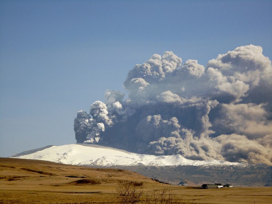
The UK and France have become the first countries to introduce a new high-resolution volcanic ash forecasting system designed to prevent a repeat of the massive aviation disruption caused by Iceland’s Eyjafjallajökull eruption in 2010.
Volcanic ash is a cloud of tiny, abrasive particles made of shattered rock, glass, and minerals that erupt into the atmosphere during a volcanic explosion. Despite the name, it is not like soft fireplace ash—volcanic ash is hard, sharp, and can travel hundreds or even thousands of miles on high-altitude winds. In aviation, ash is dangerous because it can damage aircraft engines, clog sensors, scratch windscreens, and reduce visibility, making accurate forecasting essential for safe flight operations.
The UK Met Office announced that its London Volcanic Ash Advisory Centre (VAAC) is now providing Quantitative Volcanic Ash (QVA) forecasts—detailed, high-resolution ash concentration models newly required under International Civil Aviation Organization (ICAO) regulations that took effect on November 27. France’s Toulouse VAAC, operated by Météo-France, has also begun offering the new forecasts.
Met Office officials say the QVA system would have dramatically reduced the 2010 airspace shutdown. If the technology had been available at the time, they estimate it could have cut aviation disruption by half.
The new forecasting approach provides ash concentration data for 12 layers of the atmosphere, covering altitudes from ground level up to 60,000 feet. It also offers probability-based forecasts showing the likelihood that specific ash concentration thresholds will be exceeded. These granular insights are expected to help airlines and regulators make more precise decisions about airspace restrictions.
“QVA data will help airlines make more informed decisions to avoid higher concentrations of ash and will minimize the airspace that needs to be closed in the event of a future eruption,” said Karen Shorey of the Met Office Aviation Team.
The shift to QVA represents a major move away from earlier criteria that relied largely on visible or discernible ash. Instead, the new method aligns with updated aircraft engine and airframe volcanic-ash tolerance standards, allowing for more targeted and evidence-based operational decisions.
According to the Met Office, the enhanced forecasts provide both single-snapshot concentration maps and probabilistic models, giving operators a clearer understanding of the uncertainty and potential spread of ash clouds during an eruption.
The QVA forecasts are being made available free of charge to all airlines and aviation stakeholders.
London’s VAAC plays a critical role within the global aviation network, as it is responsible for monitoring and issuing forecasts for volcanic activity originating from Iceland and the northeastern North Atlantic—one of the world’s most volcanically active regions.
The Eyjafjallajökull eruption in April 2010 forced the closure of most European airspace for nearly a week, grounding thousands of flights and disrupting travel for as many as 10 million passengers. Airlines and industry groups sharply criticized the scale of the shutdown, arguing that a lack of precise ash-concentration data led to unnecessarily broad restrictions.
With the introduction of high-resolution QVA forecasting, UK and French authorities say the aviation industry is now far better equipped to respond to future volcanic events with improved accuracy, reduced uncertainty, and less disruption for travelers.
Related News: https://airguide.info/category/air-travel-business/travel-health-security/
Sources: AirGuide Business airguide.info, bing.com, aviationweek.com