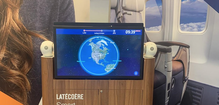
Interactive map feature now available on Latécoère Smart LiFi Monitor

A tech collaboration has enabled FlightPath3D’s interactive moving map to be displayed on Latécoère’s Smart LiFi Monitor, a setup that provides passengers with detailed 360° visuals of their aircraft, alongside flight progress and destination data. High-fidelity satellite imagery can also be broadcast on bulkhead monitors and connected passenger devices.
Latécoère’s Smart LiFi technology includes a smart 4K monitor that uses light to transmit data. It can be interfaced with any in-flight entertainment (IFE) provider or can work standalone.
Laurent Groux, director of Latécoère, said, “The flight journey is captivating with our 4K Smart LiFi monitors and FlightPath3D moving map. Augmented views and satellite imagery are crisp, clear and displayed with detailed visuals. FlightPath3D offers one of the most compelling and innovative 3D moving map experiences, with customisation potential from interest for corporate use.”
